6.7 km away
Icefloe Lake and Avalanche Divide
Incredible vistas combined with the highest lake in the Teton Range!
Moderate Hiking
- Distance
- 6.2 km
- Ascent
- 372 m
- Descent
- 372 m
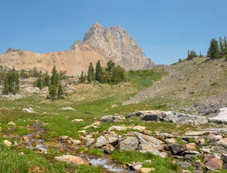
An incredibly steep approach to Table Mountain rewarded with stunning views of the Tetons.
Hiking Extreme

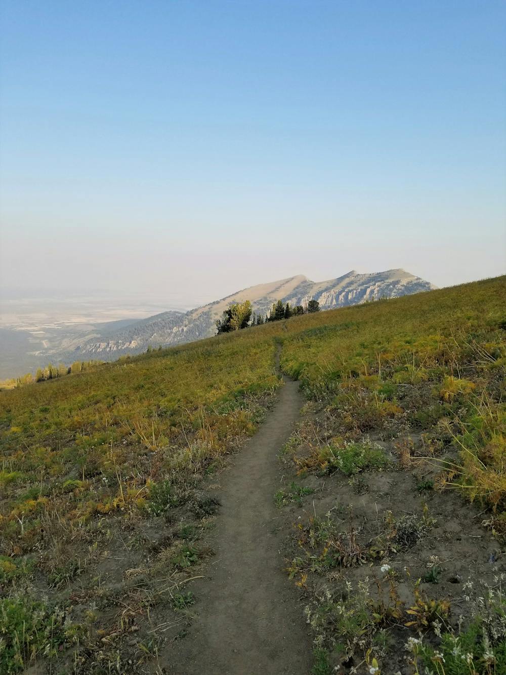
Table Mountain is accessible via two different trails: Face Trail (#029) and North Teton Creek Trail (#024). The Face Trail is an incredibly steep approach, and is typically used as the way up if you intend to hike a loop. This is not only a local favorite, it is one of the most challenging and exhilarating hikes in the Tetons. It is very easy to underestimate the time required for this route as steep pitches, high elevation, and exhilarating views will all take your breath away.
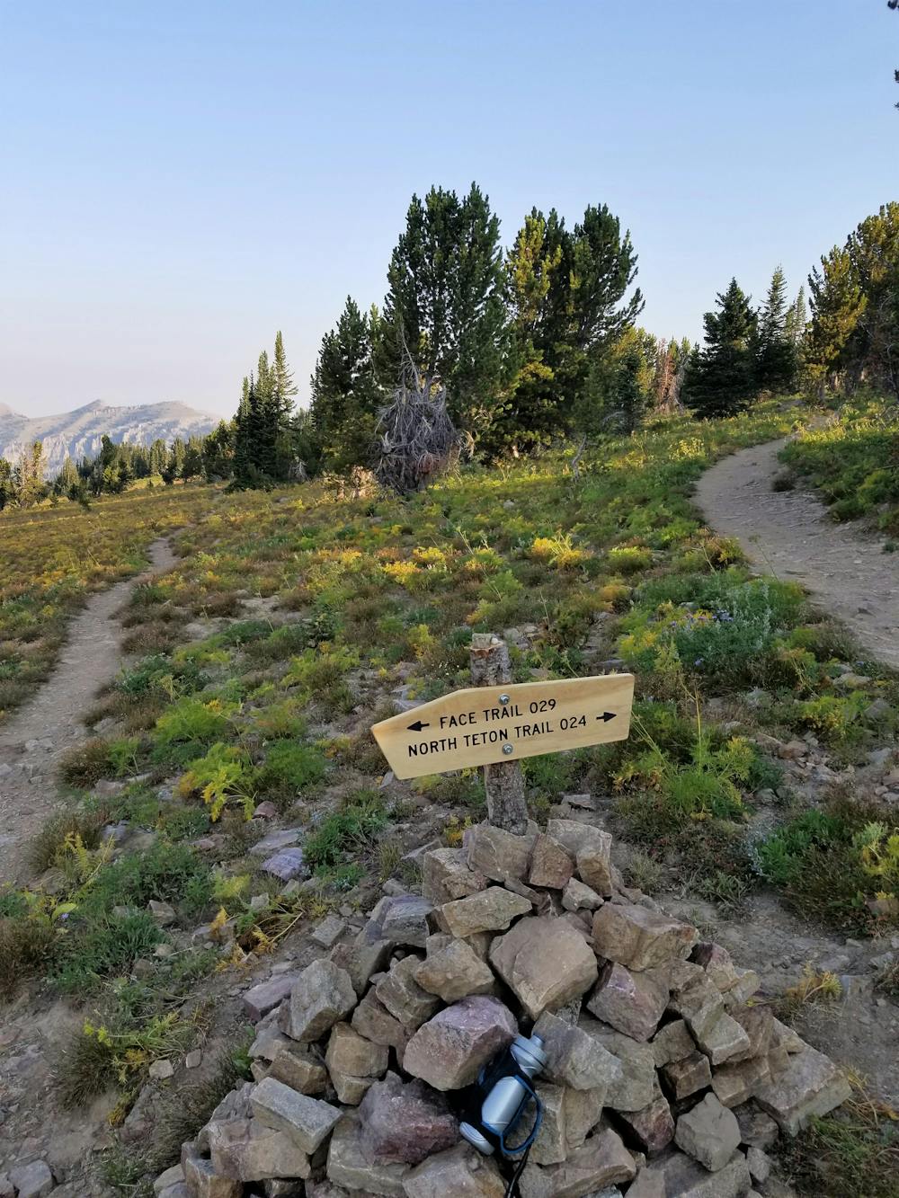
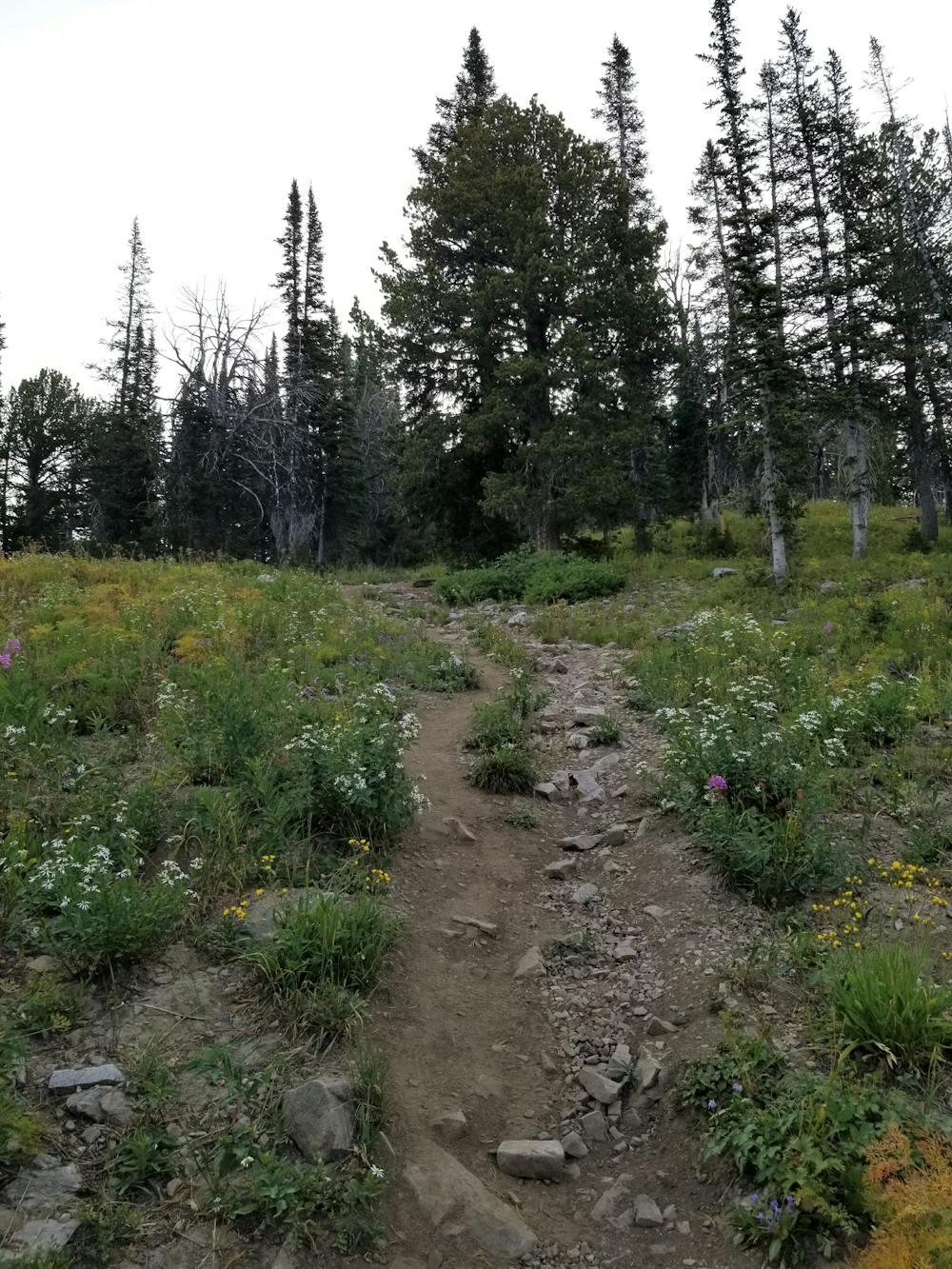
North Teton Creek Trail, also known as Huckleberry Trail, is the adjacent route up, but at a significantly easier grade. If you're planning to backpack in the area and you are carrying a significant amount of gear, the North Teton Creek Trail would be a safer route due to its pitch.
If day hiking or trail running, head up Face Trail to push your limits with a 3 mile, 3000' climb. Rewarding your efforts, the trail then levels out and gradually traverses a beautiful, exposed narrow plateau before merging back into the North Teton Creek Trail. With steep slopes on both sides, this segment of trail will give you the adrenaline rush needed to push up the remaining climb to the summit.
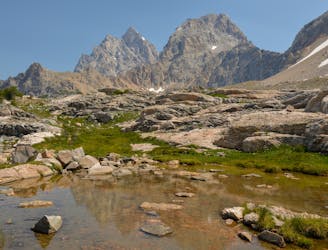
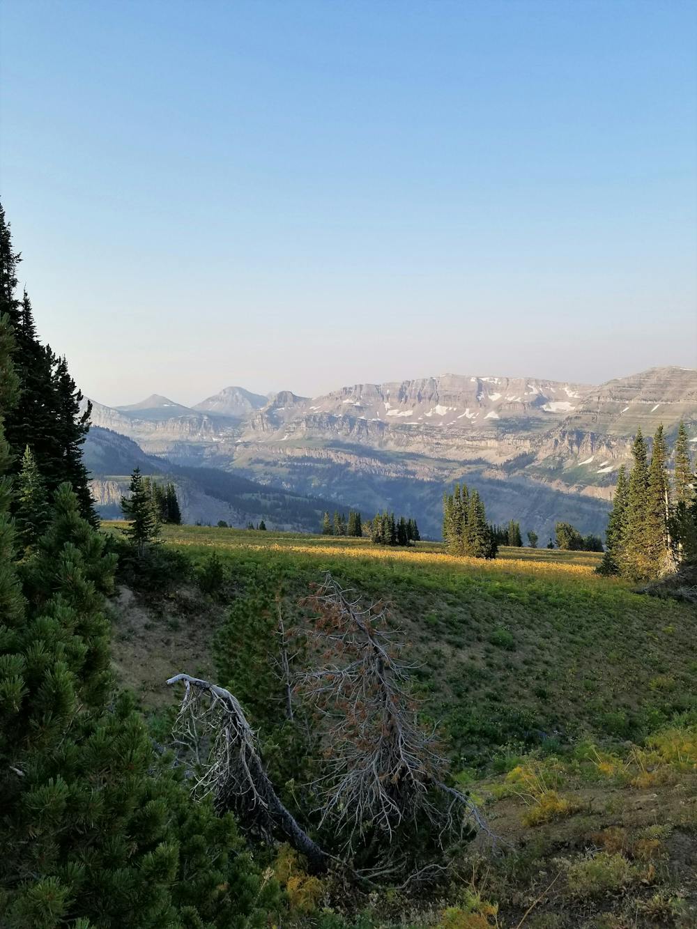
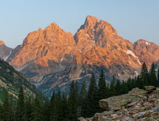
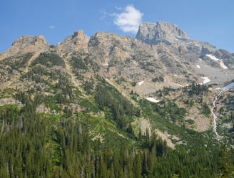
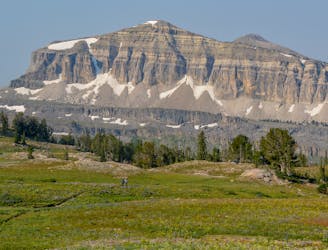
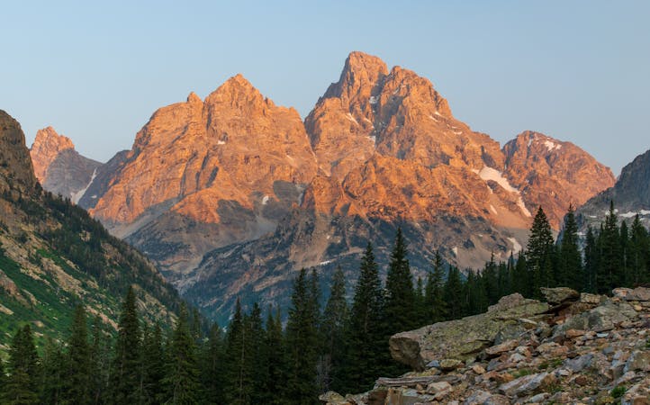
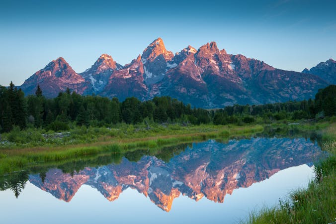
This loop is what most refer to as a reverse lollipop. The "stick" is the final approach up to the top of Table Mountain, just above 11,000'. After a short and final scramble to the top, you'll be rewarded with incredible views of the surrounding Teton Basin, with the Grand, Middle, and Lower Tetons directly across nearby Cascade Canyon.
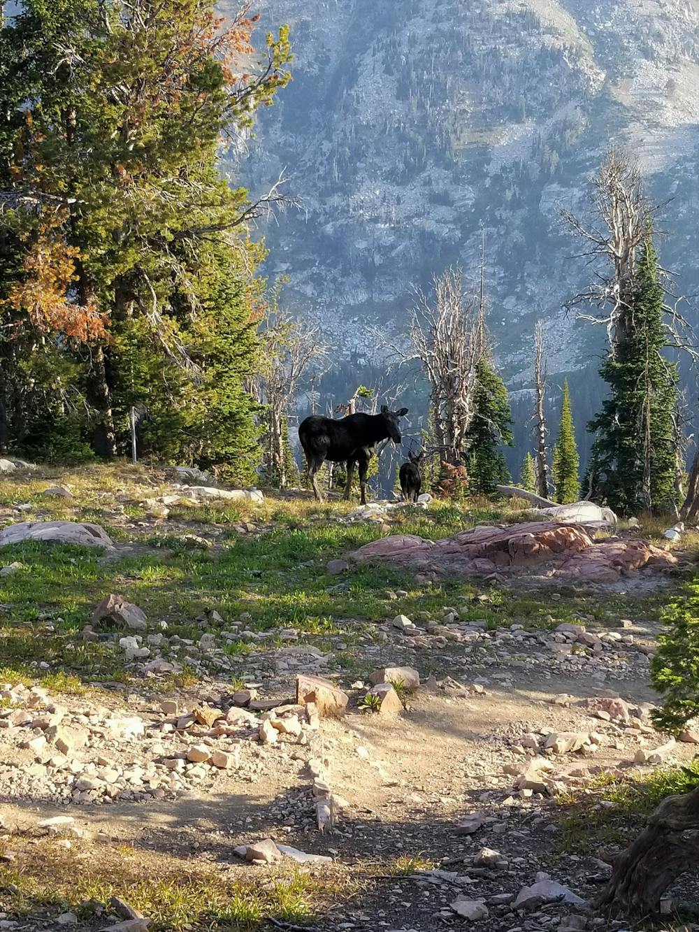
On the return trip, there are a handful of options if you want to make a multi-day trip of it. At the intersection with Face Trail, keep right and you will be greeted with several remote and primitive camping opportunities along the way down. Be aware of your surroundings in this area though, as larger wildlife including moose, are often present.
After a series of switchbacks, the trail turns sharply to the northwest and begins the long, sustained descent to the trailhead following the North Teton Creek.
Extreme
Scrambling up mountains and along technical trails with moderate fall exposure. Handholds are necessary to navigate the trail in its entirety, although they are not necessary at all times. Some obstacles can be very large and difficult to navigate, and the grades can often be near-vertical. The challenge of the trail and the steepness of the grade results in very strenuous hiking. Hikes of this difficulty blur the lines between "hiking" and "climbing".

The trail contains some obstacles such as outcroppings and rock which could cause injury.

Little chance of being seen or helped in case of an accident.
6.7 km away
Incredible vistas combined with the highest lake in the Teton Range!
Moderate Hiking
7.4 km away
An epic final day on the Teton Crest Trail.
Difficult Hiking
7.4 km away
One final stretch through beautiful Cascade Canyon
Moderate Hiking
8.4 km away
One of the most beautiful sections of trail in the Tetons.
Difficult Hiking
8.4 km away
A must-do side trip off the Teton Crest Trail.
Extreme Hiking
7 routes · Hiking

25 routes · Alpine Climbing · Hiking
5 routes · Alpine Climbing · Hiking
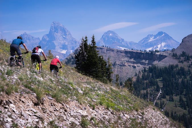
4 routes · Mountain Biking · Hiking · Trail Running
11 routes · Hiking · Trail Running