How to Hike to Table Mountain in Wyoming (For the BEST Views of the Tetons!)
Are you looking for an uncrowded hike near Grand Teton National Park with epic views? Then Table Mountain in Wyoming should be on your bucket list. The Table Mountain hike is a challenging climb to an 11,000 foot summit, but provides some of the best views over the Teton Mountain range. In this guide, we’ll go over everything you need to know to hike to Table Mountain in Wyoming, including how to get there, route options, what to expect on the trail, and more!

Grand Teton National Park is home to probably one of the most recognizable skylines in the country. We’ve visited this park several times, and we don’t think we could ever get sick of those iconic mountain views.
Not only are these mountains incredibly picturesque, but they contain hundreds of miles of epic hiking trails that take you to beautiful passes, gorgeous alpine lakes, and colorful valleys for even more amazing views and scenery.
People come from all over to get these Instagrammable views, but that means that the hiking trails in the Tetons can get pretty crowded, and often, you might be fighting for parking spots at some of the best and most well-traveled trailheads.
But what if we told you that you can get some of the best views of the Tetons without the crowds?
Did we get your attention? Then keep on reading…
Table Mountain in Wyoming is an 11,000 foot summit that sits on the far less-visited west side of the Teton Mountain range. While it sits just outside of park boundaries in the Caribou Targhee National Forest, the views from the top of Table Mountain provide some of the best, most in-your-face views of the Tetons we’ve seen (and we’ve hiked a lot in the National Park!).
If getting views without the crowds is your thing (yes, please!), then hiking to Table Mountain near Grand Teton National Park should be on your list, and in this guide, we’ll share everything you need to know to hike Table Mountain in Wyoming. We’ll go over when to go, how to get there, trail options, what to expect, and more. So, let’s get to it!
In this Table Mountain, Wyoming hiking guide:
Where is Table Mountain in Wyoming?

Though Table Mountain has amazing views of the Teton Mountain range, it is not in Grand Teton National Park itself.
Instead, Table Mountain is found just outside of Alta, Wyoming, on the quieter and less visited western side of the Teton Mountains in the Caribou Targhee National Forest that borders the park. While the majority of people flock to the eastern side of the range to hike the trails in Grand Teton National Park (and understandably so!), you’ll find quieter trails and solitude on the western side.
How to get to the Table Mountain trailhead
The trailhead for the Table Mountain hike in Wyoming is found at the end of Teton Canyon Road outside of Alta, Wyoming.
No matter where you are coming from, you’ll approach the west face of the Tetons from Driggs, Idaho before crossing over into Wyoming in the small town of Alta. You’ll follow Alta Ski Hill Road (the main road through town) and take a right onto Teton Canyon Road. You’ll follow this dirt road for approximately 4.5 miles until you reach the end. Even though the road is unpaved, it should be doable in any car.
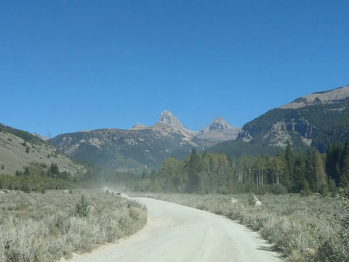
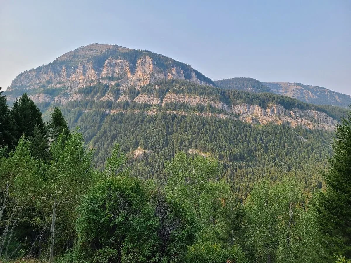
The Scenic Teton Canyon Road, with the Grand Teton towering in the background
At the end of the road, there are two back-to-back trailheads. The first is for the North Teton Creek Trail (Trail #024). The second is for the Face Trail (Trail #029). Both of these trails go to Table Mountain and can be made into a loop to hike Table Mountain, and we’ll talk about each of them below and what we would recommend.

The first trailhead for Table Mountain (for the North Teton Trail)
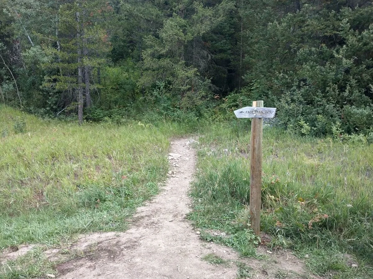
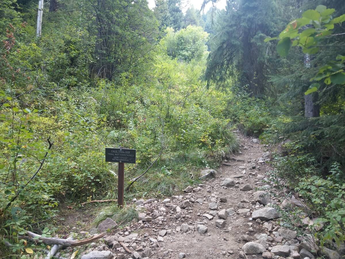
The trailhead for the Face Trail up to Table Mountain
Table Mountain Wyoming trail map
Here is a map of the Table Mountain hike in Wyoming, found right at the trailhead. The first trailhead is labeled as NORTH TETON and goes up trail 024, while the second trailhead is labelled SOUTH TETON and goes up trail 029. For some reason, Table Mountain itself was not labeled on this map, but we have added it in here.

Table Mountain trail map
How Long is the Hike to Table Mountain in Wyoming?
As we mentioned above, there are two trails to Table Mountain in Wyoming, the North Teton Trail and the Face Trail.
The North Teton Trail is a bit longer (6.6 miles one-way) than the Face Trail, but less steep, while the Face Trail is shorter (4.1 miles one-way) but quite a bit steeper (and by steep, we mean steep!). Both climb just over 4,000 feet to get to the 11,106 foot summit of Table Mountain.
It’s possible to hike to Table Mountain as an out-and-back hike on either of these trails, however, it is common to do the Table Mountain hike as a loop. If you choose to do it this way, we recommend going up the Face Trail and down the North Teton Trail. The Face Trail, as you will see in just a bit, is steep, and coming down it would be very rough and taxing. It’s longer to go down on the North Teton Trail, but it will save your knees, and allow you to get some different scenery on the way down.
We did the Table Mountain hike as a loop, going up the Face Trail and down the North Teton Trail. Here are our trail stats logged from our tracking watch.
Distance: 10.98 miles
Elevation gain: 4.183 feet
Time: 9 hours
Trail profile:
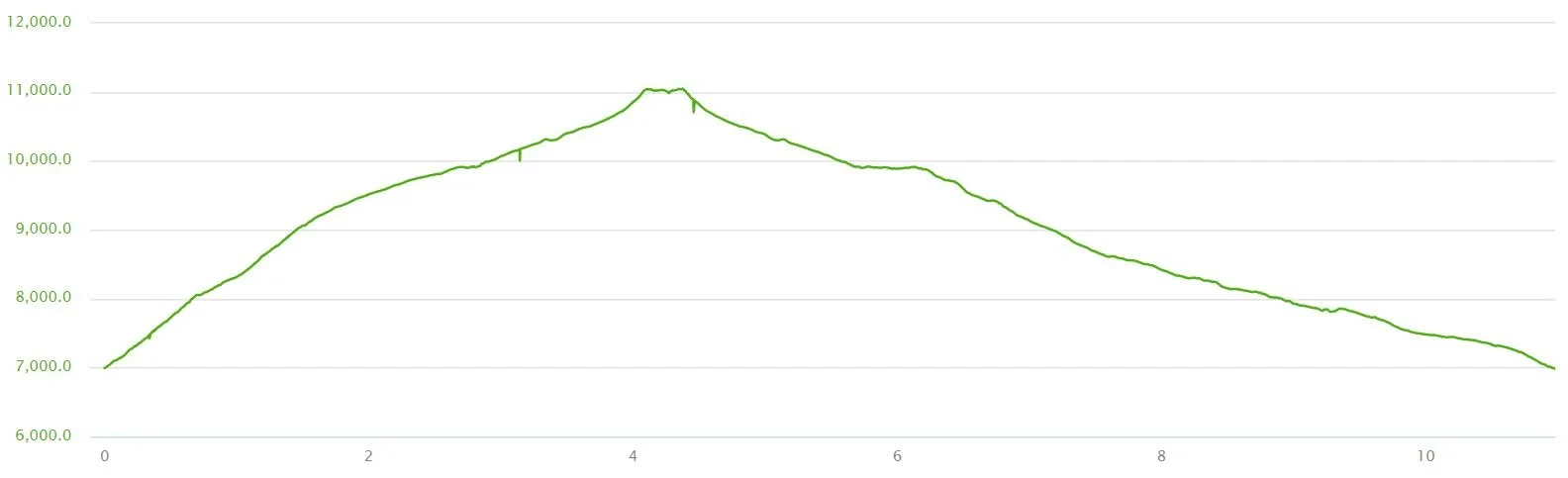
Elevation profile of the Table Mountain Trail in Wyoming, going up the Face Trail and down the North Teton Trail
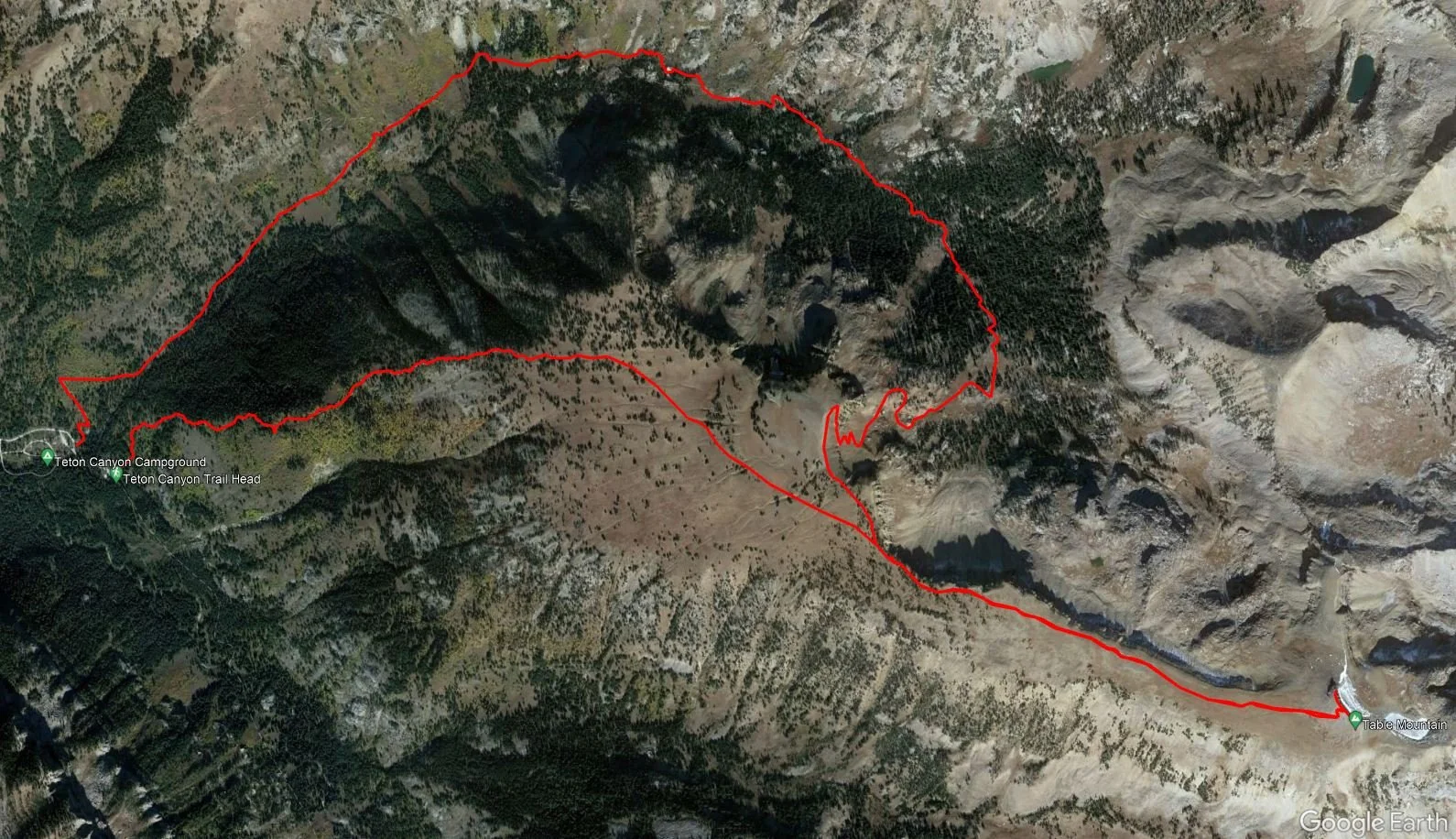
A satellite view of our hike to Table Mountain in Wyoming from our tracking watch
It took us 9 hours total for the Table Mountain hike, but that’s with over an hour of well-deserved relaxing at the summit. We would say to budget about 6-8 hours of hiking time for the Table Mountain hike. We were going up at about a 1 mph pace, which we expectedness given the steepness and altitude, and were able to make up some of that time on the way down.
How hard is the hike to Table Mountain in Wyoming?
We’ll be honest…the hike to Table Mountain is a grind. There’s nothing technical about it, but there’s just a lot of elevation gain in a short distance, so it really is a matter of mental fortitude to keep yourself going.
The Face Trail in particular is incredibly steep. There are some rather hilarious reviews out there of this trail, which in hindsight, are pretty accurate to us now…phrases like “makes you question your life’s decisions…”; “highly recommend if you want to contemplate your life choices for 2 miles while walking straight up at a sickening incline…whoever made this trail I am almost positive ended up in a psych ward”. Pretty funny! But also pretty true…
For reference, in the first mile we clocked in a 1,300 foot elevation gain! This first mile is the steepest part of the whole hike, but the second mile wasn’t much better at 1,200 feet of gain. Overall, the Face Trail up to Table Mountain was probably the most consistently steep non-technical trail we had ever hiked up to that point (until we visit New Zealand, that is!...).

To make the situation even worse, don’t forget that you’ll be doing this steep climb at altitude. The trailhead starts at about 7,000 feet and just goes up from there. You’ll want to try to be well-acclimated for this hike by doing less strenuous hikes at lower elevations and working your way up from there, and if you can, spend a night or so at higher elevations as well (basically, don’t just hop off a plane and tackle this hike right off the bat!). As you’re hiking, take it slow, listen to your body, and turn around if you need to. And be sure to stay well hydrated before and during your Table Mountain hike to ward off any altitude sickness as well.
Both trails meet up at the end before the final climb up to the summit. This final portion of the Table Mountain hike has a small section of scrambling, but it’s nothing scary or difficult.

Which trail should you hike to Table Mountain in Wyoming?
Regardless of which trail you take to Table Mountain, it’s going to be a long steep hike, but here’s what we have to say on each of the two Table Mountain trails to help you decide how you want to hike it.
The Face Trail is incredibly steep, as we said above. And it starts climbing right from the trailhead, with no warm- up for the legs at all! The first two miles are the steepest as it goes up loose slippery rock. After that, it seems to let up just a little bit, but it’s still quite a climb, and at this point, your legs will be tired and you’ll be even higher in altitude, making the climb still just as difficult as the start. It’s definitely a grueling trail.
As we were climbing the Face Trail, I just kept thinking to myself, “We should have just come up the other trail!”. I was feeling like I was going so incredibly slow up the steep Face Trail and that, even though it was longer, we would have made it up the North Teton Trail faster. But as we hiked down from Table Mountain on the North Teton Trail, my opinion changed.
The North Teton Trail is long so it’s not as steep, but it still climbs 4,000 feet and it’s still a very consistent climb that would still be pretty strenuous. Plus, you would start to see Table Mountain off in the distance pretty early on, about 2.5 miles into the hike. From here down in the valley, it’s pretty crazy how far and high Table Mountain looks, and I don’t know about anyone else, but for me, that would have been totally demoralizing to me! As we hiked out, I kept looking back in disbelief that we were all the way up there not too long ago.

Views of Table Mountain from the North Teton Trail
To sum it up, either Table Mountain Trail would be a long hard hike. It really depends on what level of steepness you can handle. You could go up and back down the North Teton Trail for a more gradual but much longer hike, or do a loop going up the Face Trail and down the North Teton Trail. But we would not recommend going up and down the Face Trail, or doing the loop clockwise, because going down the Face Trail would be rough and painful on the knees because of the steepness combined with all of the loose rock.
Do You Need a Permit to Hike Table Mountain Near Grand Teton National Park?
Because the Table Mountain hike lies outside the boundary of Grand Teton National Park, no National Park pass is needed! In fact, there are zero entry fees or permits to hike Table Mountain, so go and enjoy!
The Table Mountain hike in Wyoming: Our Experience
We’ve continually mentioned how difficult and steep the Table Mountain hike is, but to really give you a good idea of what the trail is like and what to expect, we’ll share our experience hiking to Table Mountain to help you decide if it’s something you want to tackle and which trail you’d want to take!
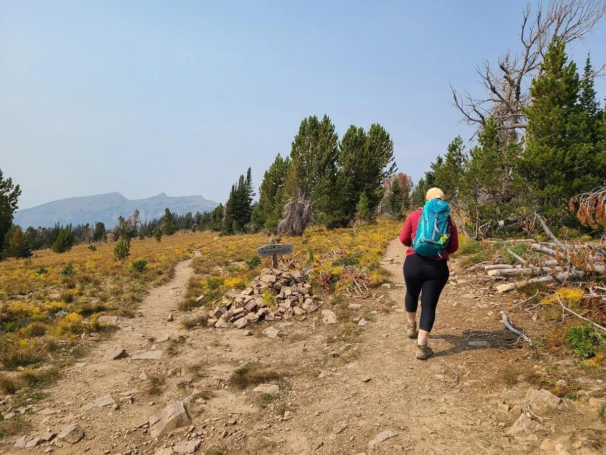
We got started on the Face Trail to Table Mountain at about 8:45 am. The trailhead is right by the bathrooms at the second trailhead parking lot at the end of Teton Canyon Road.
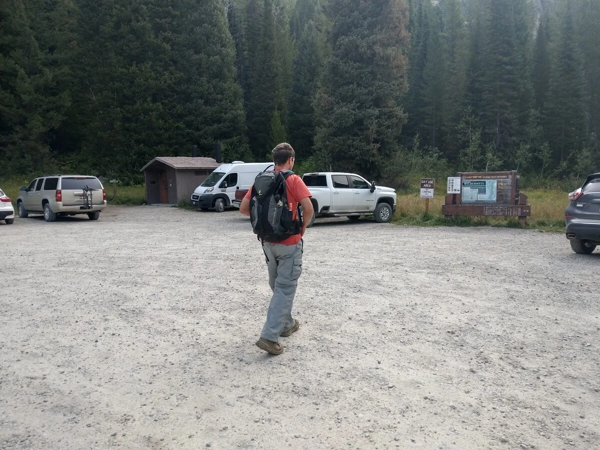
The Table Mountain trailhead for the Face Trail is where the sign is just to the left of the vault toilet in the picture above
The start of the Face Trail greets you right off the bat with this rather intimidating sign. We had never seen a trailhead sign warning so strongly of steepness, so we knew it was gonna be rough…
And steep it was. From the moment you step on the trail, the path climbs, and it’s pretty relentless for the first couple of miles of the hike. You might to do a good warm-up for your legs in the parking lot before starting this one.
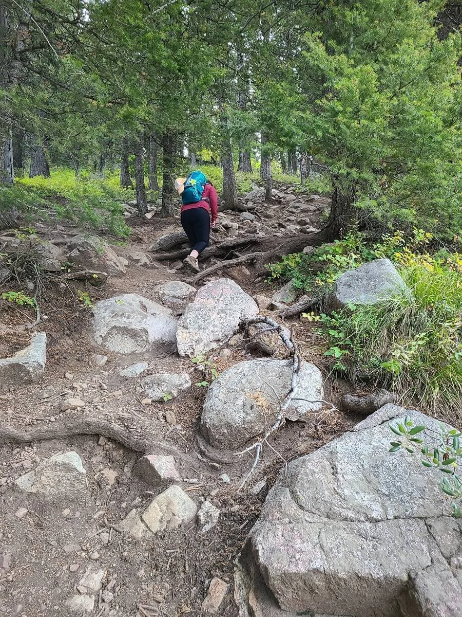
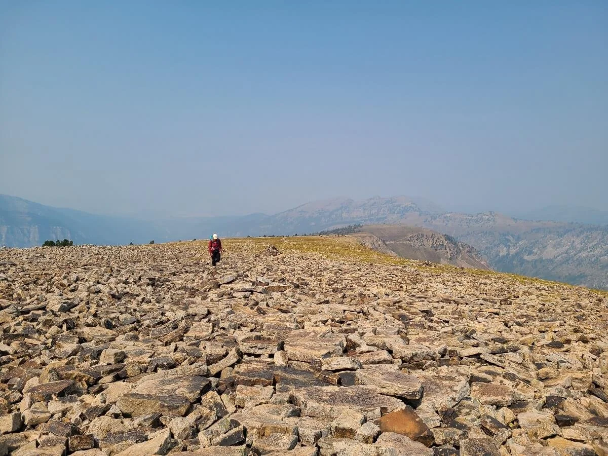
In the first mile alone, we climbed 1,300 feet, and a lot of it was up loose and slippery rock. The first part is mostly through the forest, although you get some views here and there along the way. But really, this is the worst part of the entire Table Mountain hike because of the steepness combined with the lack of any substantial views.

You’ll catch some views like this as you head up the beginning of the Face Trail to Table Mountain

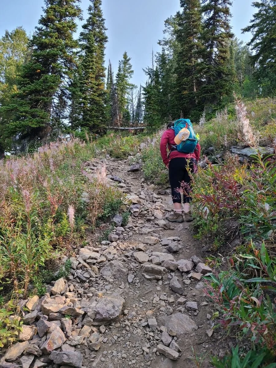
The steep and rocky Face Trail up to Table Mountain
At about 1.6 miles into the hike, the climbing started to ease up a little bit, and by mile 2, we had climbed another 1,200 feet (for anyone keeping track, that’s about 2,500 feet in 2 miles!). To be honest, these first two miles were pretty rough for me. My legs were really feeling it by this point, and I was feeling the altitude quite a bit on this hike. To add injury to insult, the skies were very smoky this morning (the forecast didn’t predict smoke until the next day!) and our views were pretty hazy. My only thought was, “Why am I doing this to myself for these lackluster views?!”. It was a pretty big mental game, but on I went…
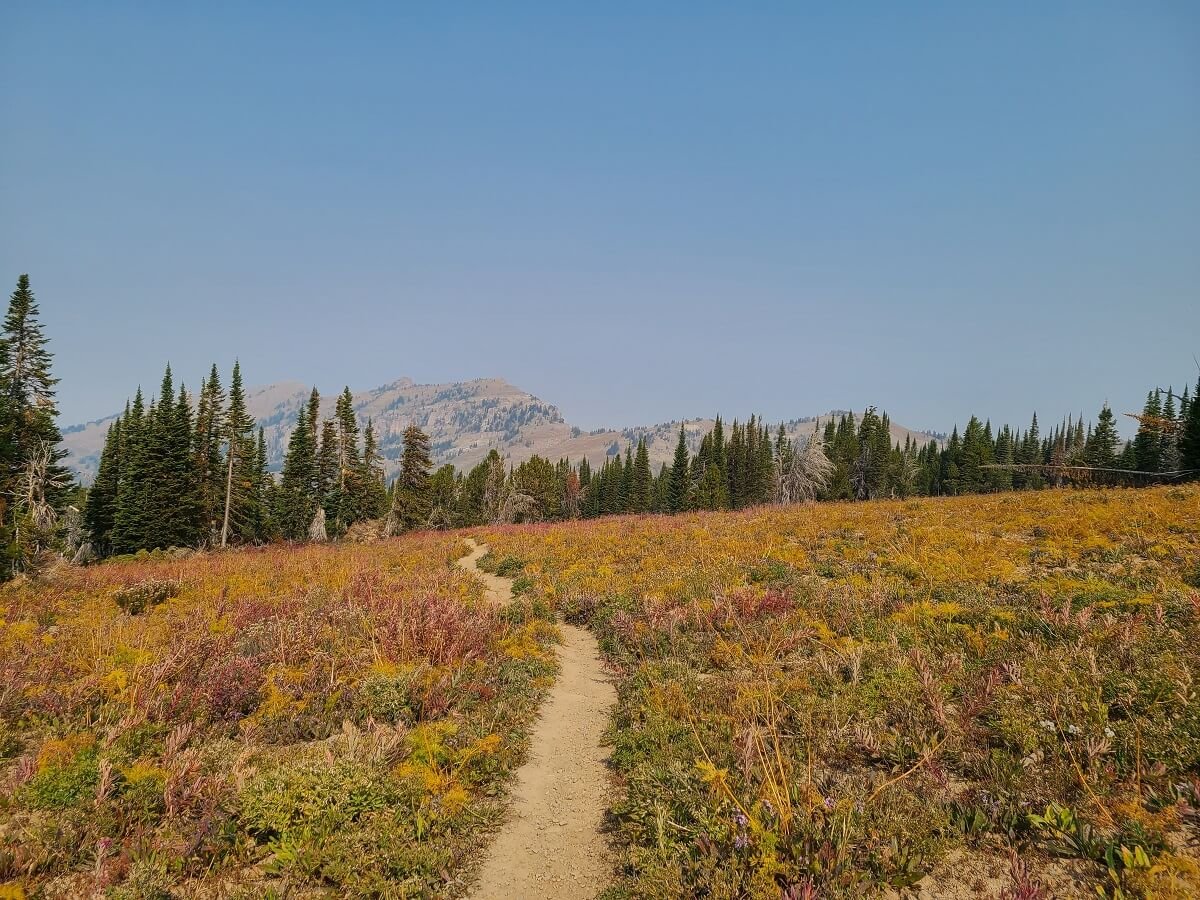
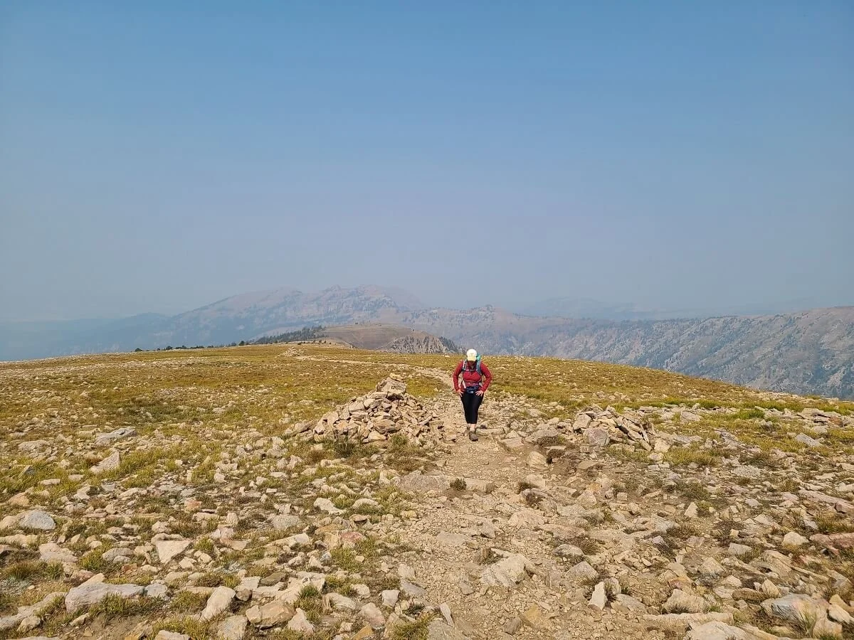
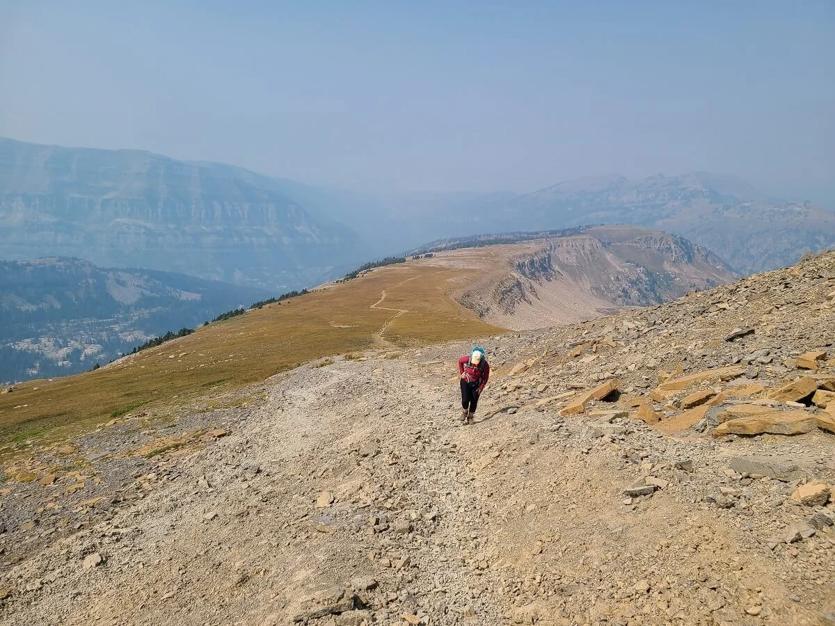
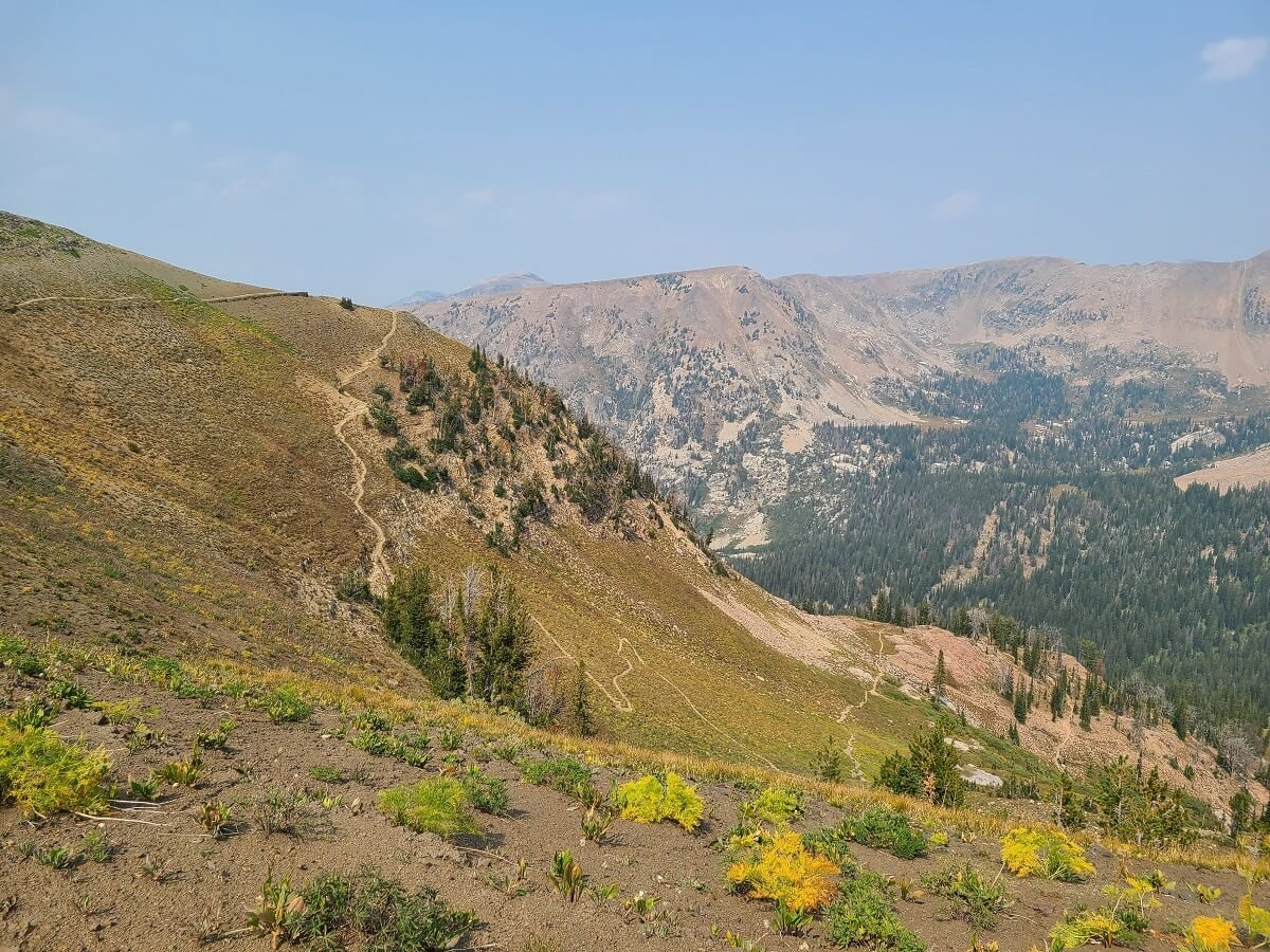
At this point, the trail had opened up, and you’ll be hiking through more of a meadow landscape with views out into Alaska Basin and the surrounding mountains. It’s not quite as steep up here, but it’s still a consistent climb. Your legs will be tired and you might begin to feel the altitude by now, so even though it eases up a bit, it’s still pretty exhausting. By mile 3, you’ll have hit about 3,000 feet of climbing!

The Face Trail starts to ease up slightly and open up with distant mountain views

Eventually you’ll come to the trail junction with the North Teton Trail. This is the trail you’ll take down to complete the loop. These two trails join up here for the final push to the summit. Continue straight here to continue up to Table Mountain.
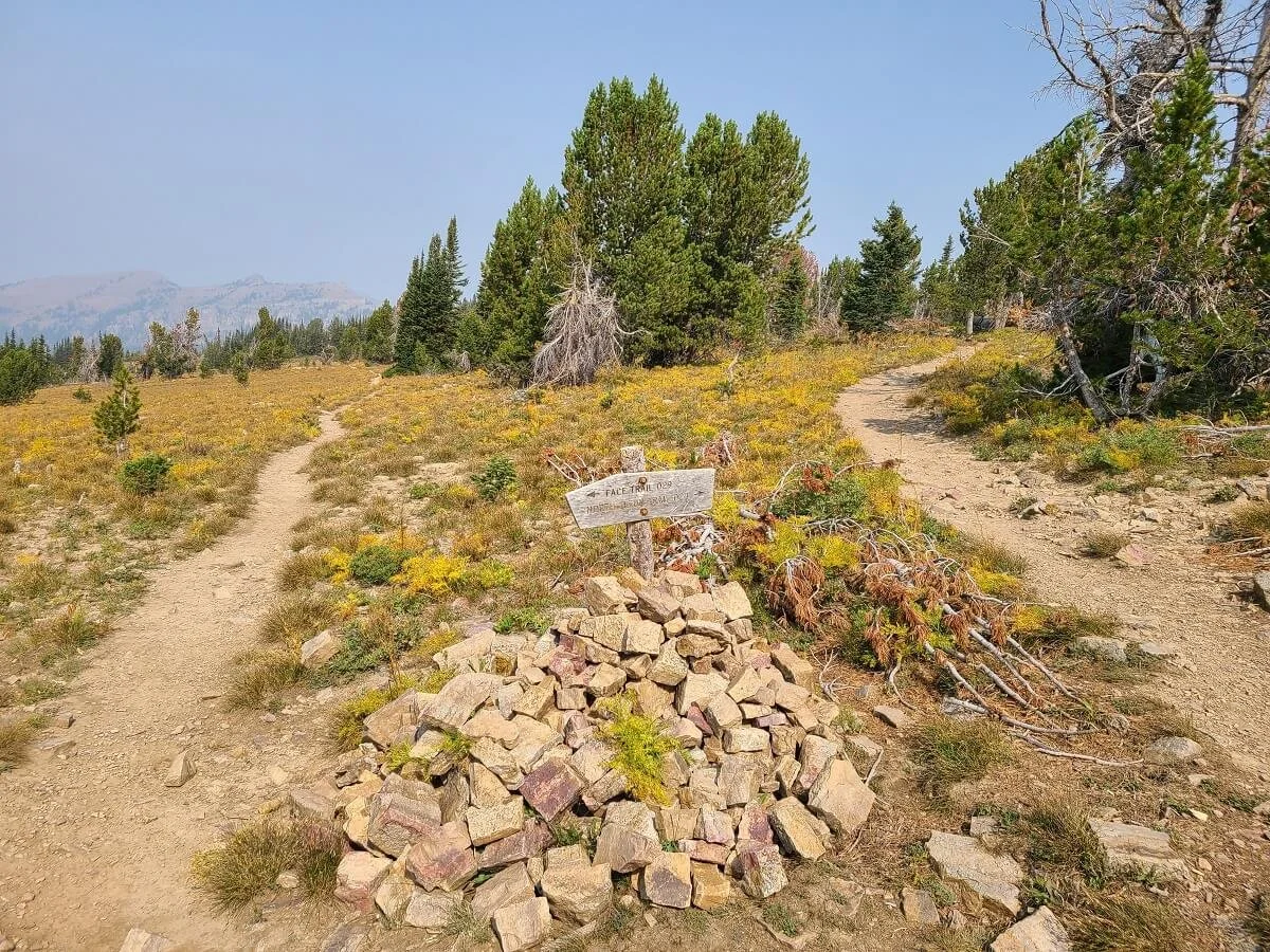
This is the trail junction with the North Teton Trail as seen when coming back down the trail from the Table Mountain summit
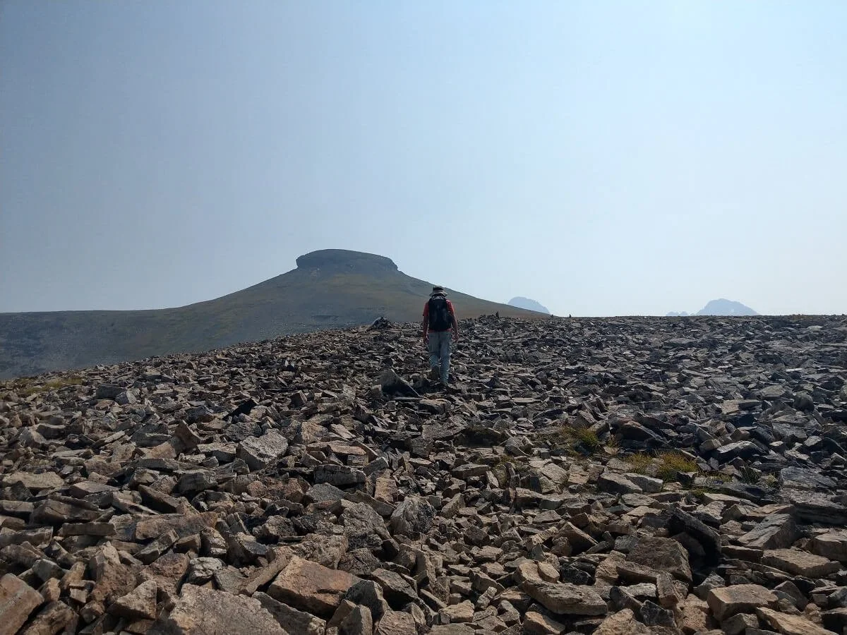
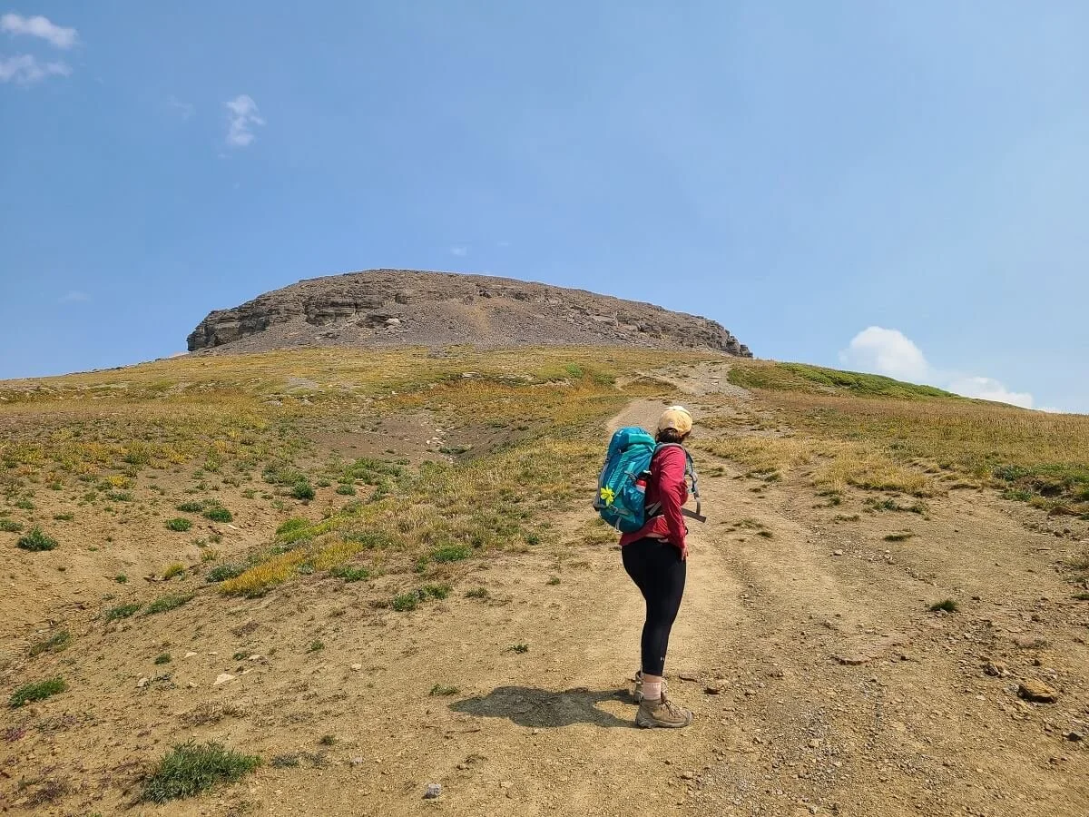
Shortly after this junction, Table Mountain will come into view. It’s hard to miss, with such a unique shape, but it looks rather intimidating at this point (at least for me, since I was already exhausted!).
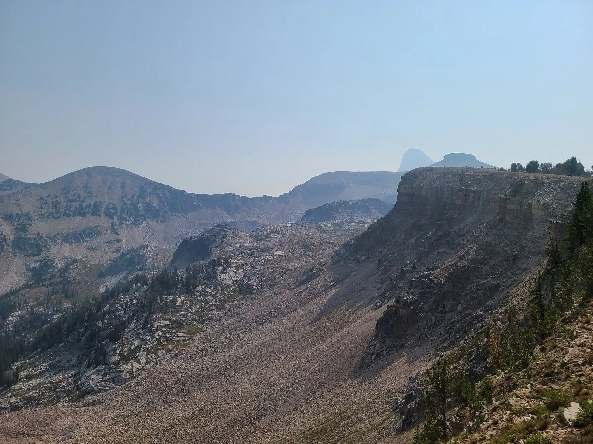
Don’t miss a small lookout on the left- hand side of the trail going up to Table Mountain. Here you can see Table Mountain sticking up, with the Grand Teton peeking out behind it!
From here, the trail becomes rockier, and you’ll have to cross a small talus field.

Getting closer to Table Mountain!
Don’t forget to look behind you for the views! You can see how hazy the skies were here!
Crossing the talus field on the way to Table Mountain
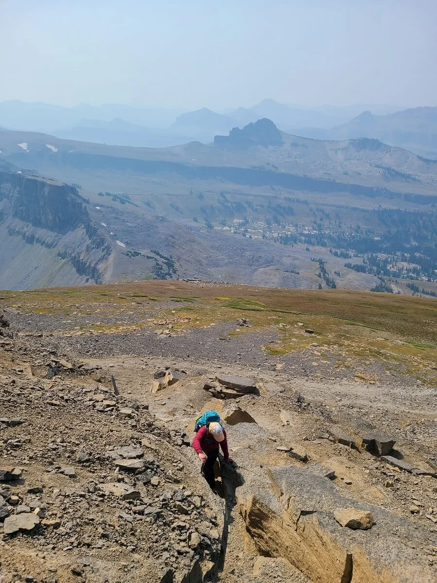
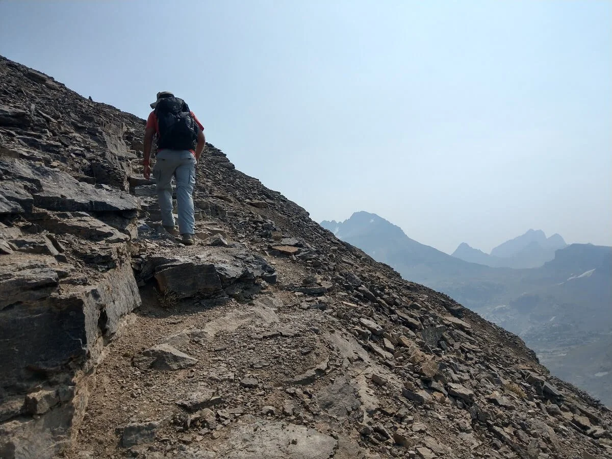
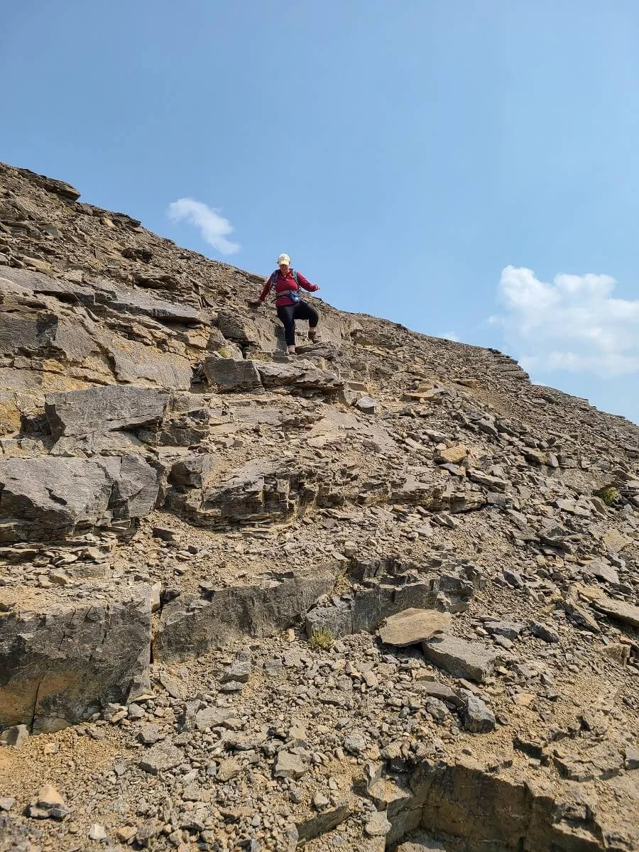
Then comes the final push up to Table Mountain, and this is where the hike becomes super steep once again. As you get closer and closer to the summit, you can see how steep the trail is, but don’t worry too much, because it doesn’t last long, we promise!
To get up to the base of the Table Mountain summit, it’s a steep climb up slippery dirt and loose rock. This part was especially rough for me, and I had to take lots of microbreaks to catch my breath. Remember, you’re at just about 11,000 feet up here!
Hiking the last steep part at the base of the Table Mountain summit!


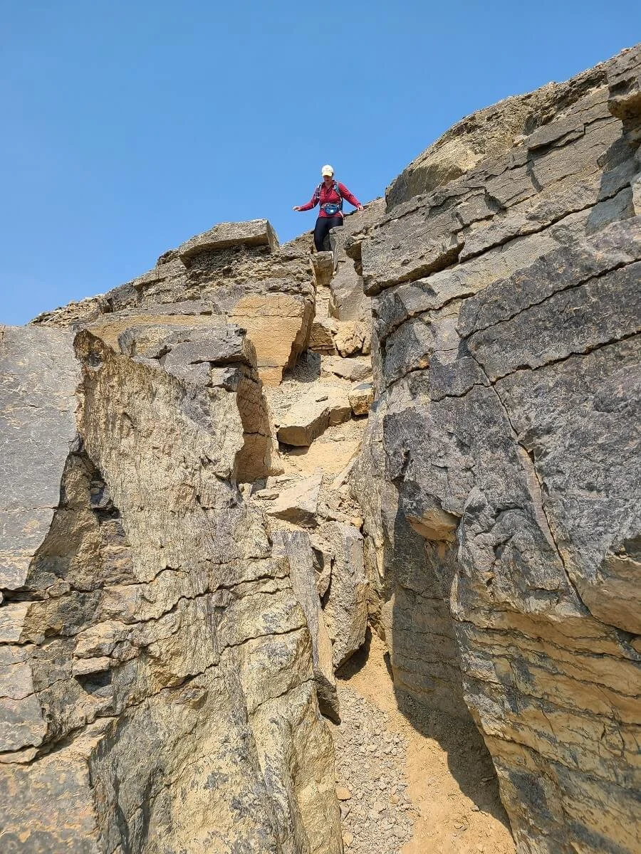
You’ll make a turn in the trail and this is where a tiny bit of scrambling happens as you have to navigate up a short rock chimney. But after climbing the chimney, I was surprised to see that we were practically there! There’s just one quick spurt of climbing and you’ll be at the Table Mountain summit!

Kevin at the top of the short chimney near the Table Mountain summit

A closer view of the chimney on the Table Mountain hike
Kevin on the final short push to the Table Mountain summit right after the chimney
Almost there!
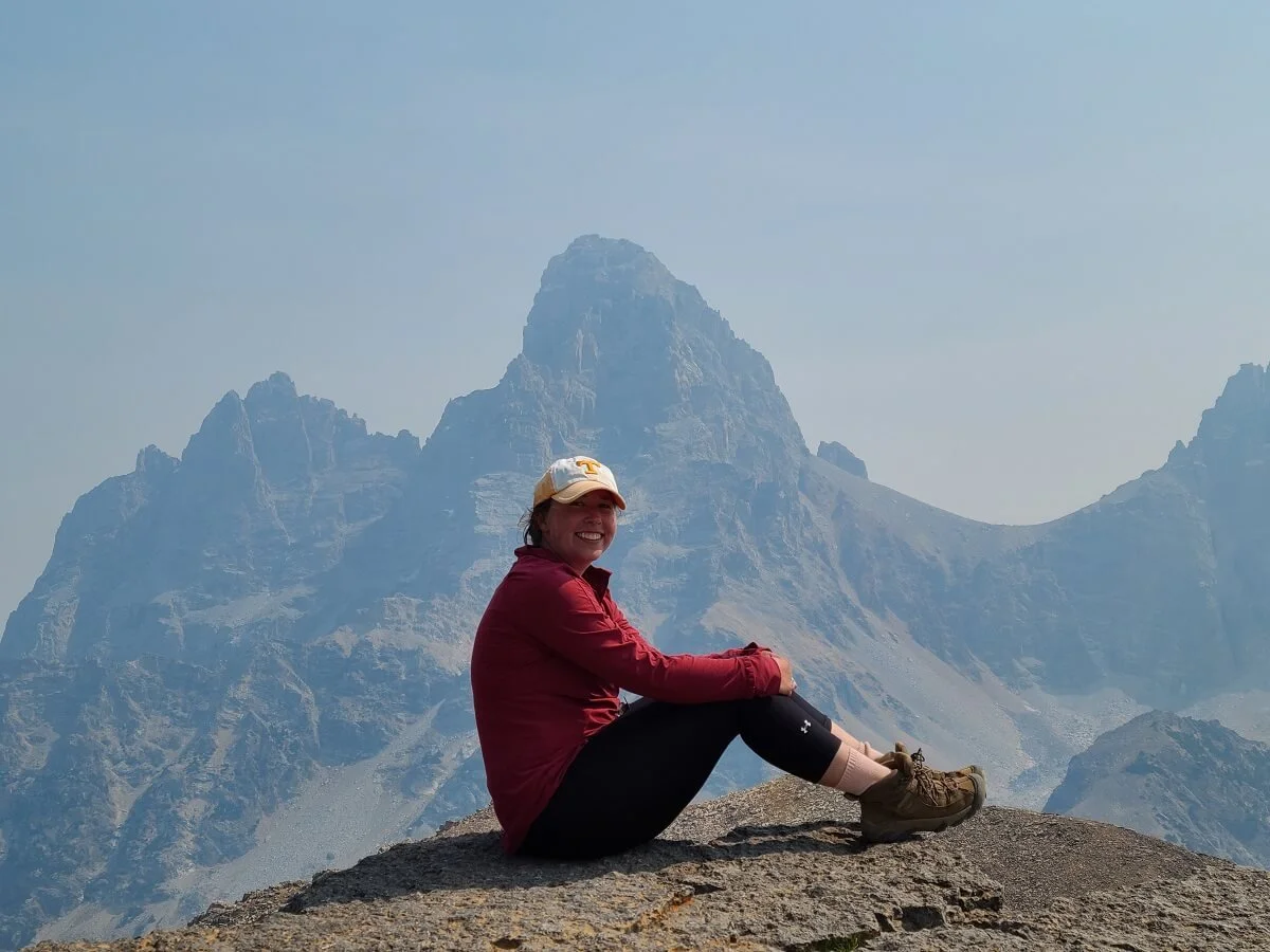
The summit of Table Mountain is actually pretty deceiving from below. It looks like it would be a huge plateau at the top, but really it’s a pretty short narrow ridge-like summit.
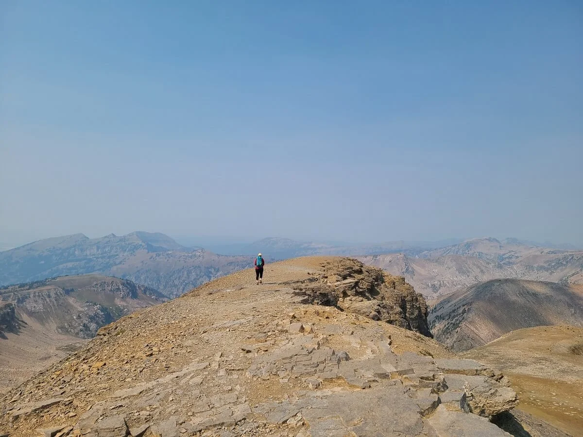
The top of Table Mountain!
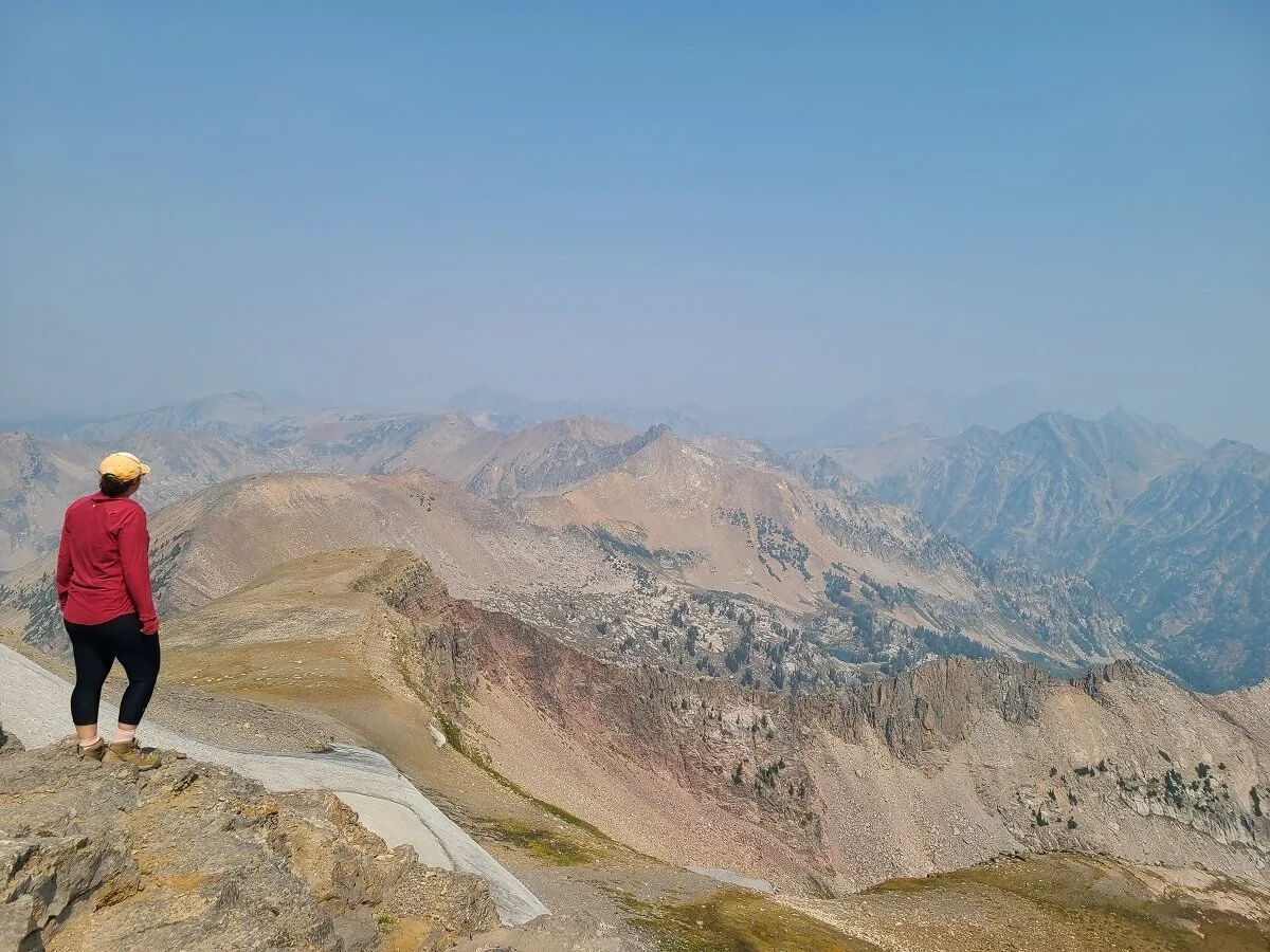
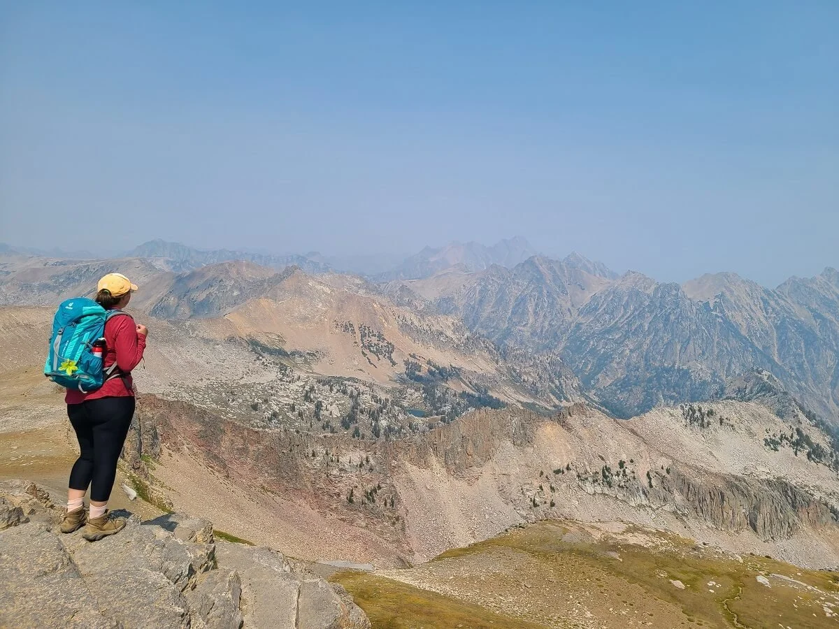
We were so happy to have finally made it, just about 4 hours after we had started the hike. But let me tell you, even with hazy skies, the views were still phenomenal! The Grand Teton, Middle Teton, and South Teton all stand right in front of you, and it looks like you could almost reach out and touch them!
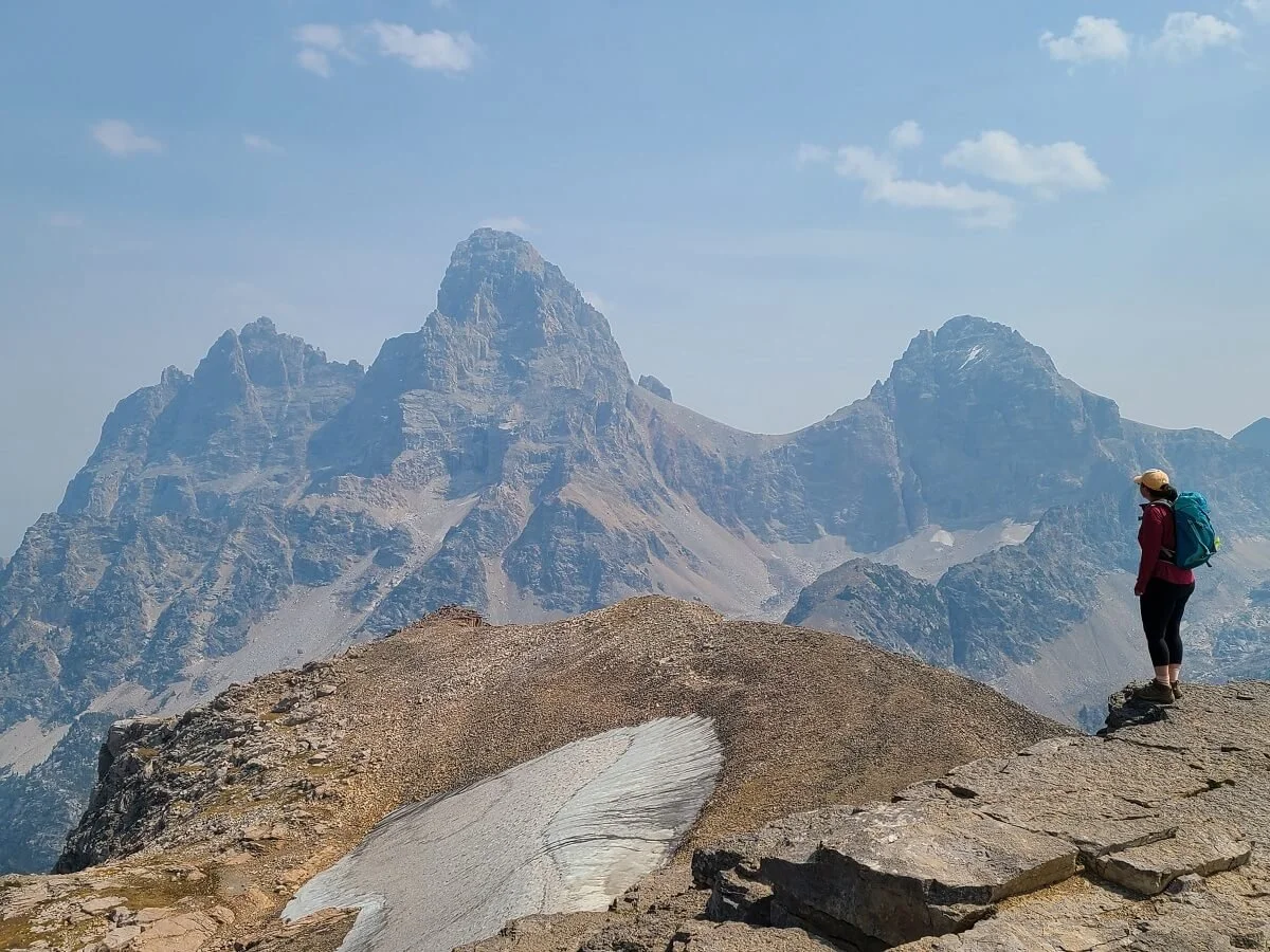
Epic views of the Tetons from Table Mountain! The Grand Teton is in the middle, and Middle Teton is on the right.
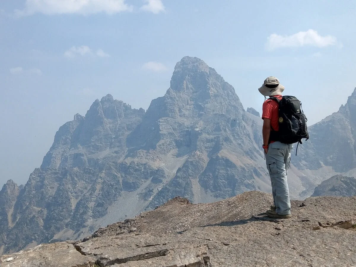
Table Mountain has the most in-your-face views of the Grand Teton you can get!

All three Teton Mountains in view!
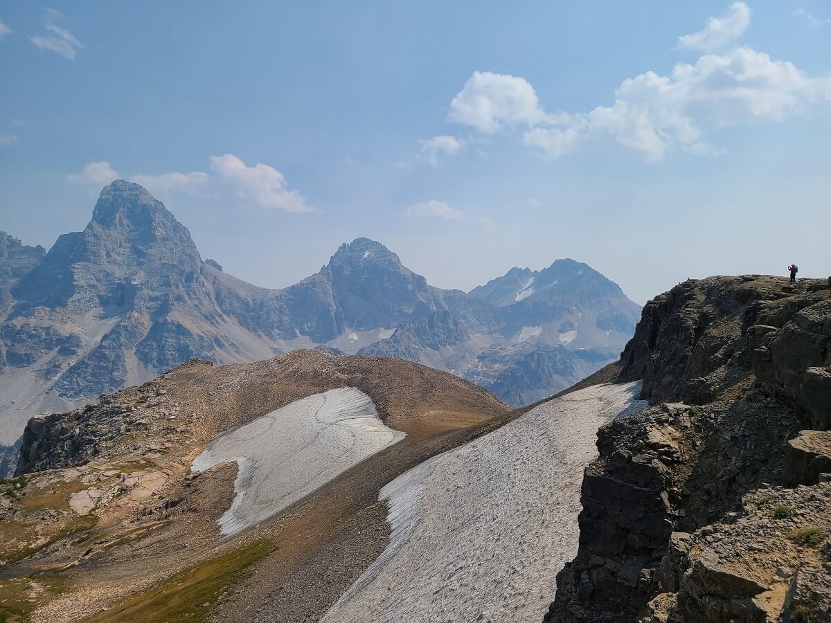
The views just North were arguably even better as they stretch out over Cascade Canyon and the South Leigh Lakes.
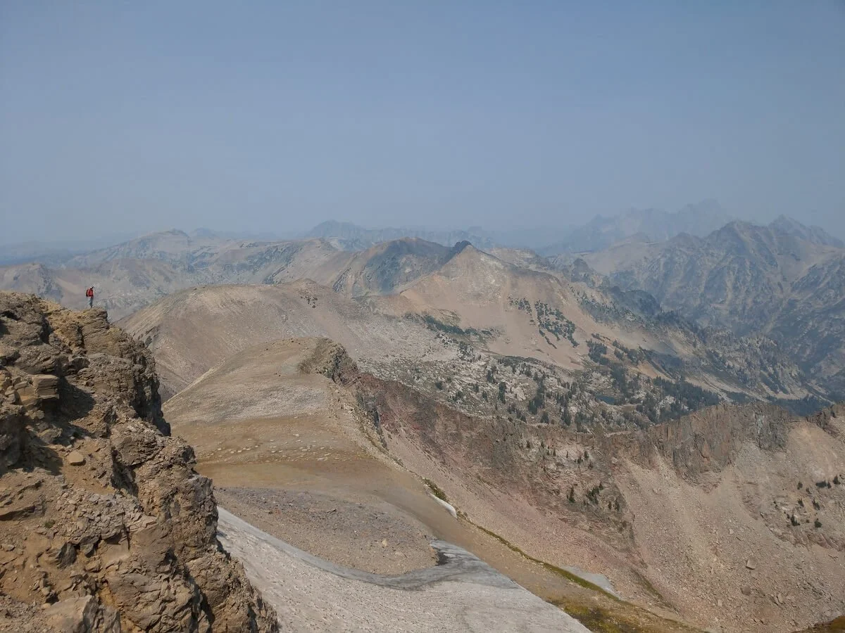
Views to the North of the Table Mountain summit…can you spot Kevin?
We enjoyed the summit views to ourselves for a bit before some locals arrived and we chatted about some good local hikes in the area. The great thing about staying up on the summit for so long was that the smoke actually cleared out quite a bit and the views of the Tetons became so much clearer!
Can you see me trying to take a picture? The Tetons really were clearing up!
After about an hour and 15 minutes of taking a much- needed rest and eating some lunch, we reluctantly began our hike out.
We got from the summit down to the base in about 15 minutes with a bit of scree sliding down the loose rock.
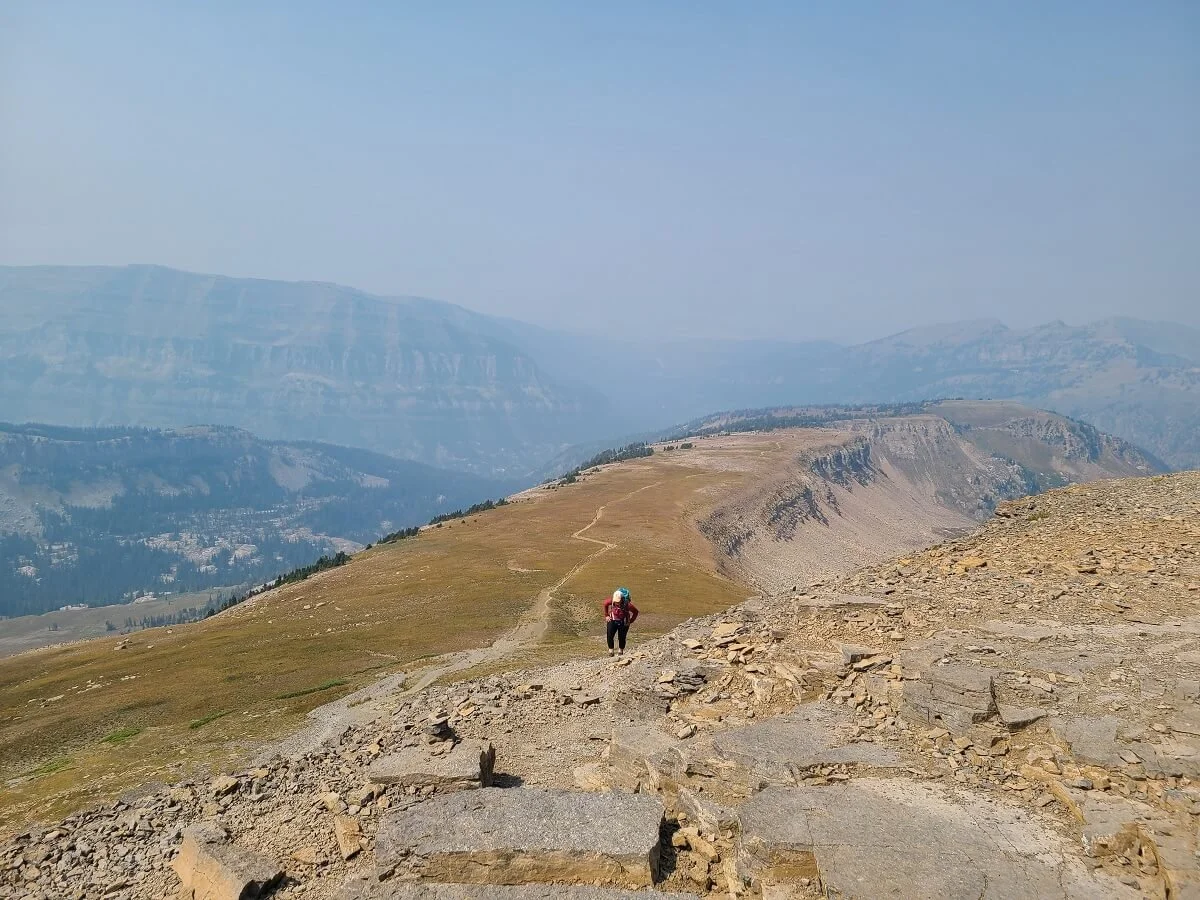
Then it’s a quick and easy walk back to the junction with the North Teton Trail. Take a right here. Up ahead on this trail, you’ll see your path down via a series of about 6 switchbacks that head steeply down into the valley. The trail is mostly dirt but with some loose rock, so watch your footing here.

The skies were much clearer for us on the hike down from Table Mountain!
Stay right to take the North Teton Trail down from Table Mountain
A view of the switchbacks on the North Teton Trail
The views from these switchbacks back towards Table Mountain and the Tetons peeking up behind were amazing!

Amazing views from the North Teton Trail. Table Mountain is such a unique-looking peak!

Hiking down the switchbacks on the North Teton Trail


Be sure to keep your eyes (and ears!) open for cute little pika and marmot hiding among the rocks alongside the trail. The little pikas can often be heard squeaking (much like the sound of a dog toy!) and you’ll probably be able to see them bounding along the rocks collecting grass for their winter homes.
Once down in the valley, it’s a steady descent through mostly open meadows back to the trailhead. You’ll be surrounded by a basin of mountains which makes this hike out beautiful (and in our opinion, much better than hiking down the Face Trail!). For a good portion of this part of the hike, you’ll be able to look back and see Table Mountain in the distance. It looks sooo far from here, and it’s crazy to think that you were all the way up there not too long ago!


Beautiful valley views from the North Teton Trail

There are a few stream crossings on the hike out from Table Mountain

Couldn’t believe we were all the way up there!
The last two miles of the hike become a bit of a slog. It becomes more forested with not much of a view, and the trail seems to not want to make its final descent until the last half mile where it quickly switchbacks down to the trailhead.

The final section of the North Teton Trail
It took us just over 3.5 hours to get from the Table Mountain summit to the trailhead on the North Teton Trail…much faster than going up given the longer distance!
Overall, the Table Mountain hike in Wyoming is a beast of climb with lots of steep elevation gain, but the views at the top are well worth it! Plus, this hike is relatively quiet compared to the busy trails in Grand Teton National Park on the other side of the range. We saw just a few other hiking groups the entire 9 hours we were on the trail.
Best Time to Hike Table Mountain in Wyoming
Similar to most alpine destinations, early to mid-summer into early fall (July to mid-October) is the best time to hike Table Mountain in Wyoming. This hike is at high elevation, and snow can linger on the trail into July. Make sure to check reviews and conditions before heading out to know what to prepare for. Teton Canyon Road itself is only open seasonally, from about Memorial Day to Thanksgiving each year.
As far as time of day goes, the earlier the better for the Table Mountain hike. You don’t really have to worry about crowds here, but you do have to worry about mid-afternoon rain and storms which can be common in the mountains. Most of the back half of the hike on either trail is exposed, so you want to be sure to be off this exposed part before any storm comes through. Plus, wet trail conditions would make the descent even rougher than it already is.
Also an early start on the Table Mountain hike is always a good idea to avoid the afternoon heat, which can be intense in the summer. And it’s also a good idea to just make sure you give yourself plenty of time to complete the hike. It’s a long strenuous climb, and you might go slower that you expect because of the altitude.
Where to Stay Near the Table Mountain Hike in Wyoming
If you want to camp near Table Mountain to get an early start on the trail, there are two campgrounds right along Teton Canyon Road, Reunion Flat and Teton Canyon, with potable water and vault toilets. The Teton Canyon Campground is right at the trailhead, so is particularly convenient for hiking Table Mountain. When we passed by, it didn’t seem full at all, and the sites seemed really nice and spaced out. Sites can be reserved in advance and are only $17 per night.
There is also free dispersed camping along Teton Canyon Road as well. This will require you to be completely independent, as there are no facilities or services when camping at these spots. Make sure to check with the US Forest Service to know where exactly you are allowed to camp and the regulations. And always remember to practice Leave No Trace principles to leave the site better than when you found it! This is what we did the night before and the night after our hike to Table Mountain, and we really loved it. It was a really peaceful camping experience, and we didn’t have to drive too far to start our hike.
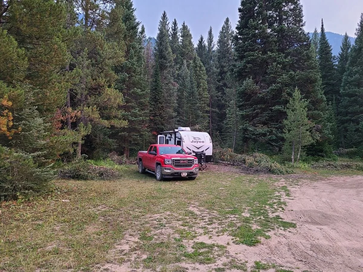
Our campsite near Table Mountain
Nearby towns to Table Mountain where you can find other accommodations include Alta, Wyoming (30 minutes away) and Driggs, Idaho (40 minutes away). Jackson Hole, Wyoming, right outside of Grand Teton National Park, is about an hour and 40 minutes away. There are plenty of camping and lodging options in this area and in the National Park, but you’ll be quite a drive away and will need a very early start to get to the Table Mountain hike.
Tips for Hiking Table Mountain in Wyoming
Check the weather forecast. Make sure you’re not going on day with storms or rain in the forecast. This can make the trail dangerous and much more difficult. Plus, it just won’t be any fun and your views will be obstructed.
Check trail conditions. Especially if you plan to come later or earlier in the season, make sure you know if there are any particularly snowy or muddy/slippery patches of trail and bring the right gear. We like to check AllTrails for recent trail descriptions by fellow hikers.
Check the smoke forecast. Unfortunately, large forest fires are commonplace in the west, and the Tetons are frequent victims of smoky skies and hazy views. Each time we’ve visited Grand Teton National Park, the smoke from nearby fires has affected our plans. We used the IQair site and Accuweather to look at forecasted air quality and liked to look at webcams to monitor visibility. Take these forecasts with a grain of salt, though. If fires are in the area, there’s always a chance of seeing the effects. On the day we did the Table Mountain hike, forecasts didn’t predict hazy skies until the next day, yet we were stuck with smoky views for most of our hike.
Acclimate to the altitude. The Table Mountain hike goes up to 11,000 feet, which is high enough to affect most people. This is an especially strenuous hike to do without any sort of acclimation. Spend a few days doing lower elevation or less strenuous higher elevation hikes, and spend a few nights above 6,000 feet or so to get your body ready. Make sure to stay super hydrated in the days before and the whole time you are in the area and hiking, as this will help ward off any sort of altitude sickness. Take as many breaks as you need and hike as slowly as you need to get up the trail…there are no trophies for the fastest hikers out here!
Bring proper trekking shoes and poles. Definitely come prepared with the right footwear for this trail. There’s a lot of loose rock, dirt, and a touch of scrambling. Trekking poles would also be helpful for those with knee issues because the descent can be tough.
Bring plenty of water and food. The Table Mountain hike is an all-day affair. Bring at least 3-4 L per person, and you may even want to bring a filter just in case. There are a few streams you will cross on the North Teton Trail that you can filter from. Staying hydrated is key at high altitude.
Bring sun protection. Most of the trail is exposed, so wear sunscreen, sunglasses, a hat, and even long sleeves to protect your skin.
Be bear aware. The Table Mountain hike lies in bear territory. It’s best to hike with someone else and to carry bear spray just in case.
More Things to Do Near Table Mountain and Grand Teton National Park
While the views from the Table Mountain hike in Wyoming provided us with some of our all-time favorite views of the Tetons, there is still plenty more to do in the area.
Grand Teton National Park likes just on the other side of the mountain range and offers tons of opportunities for epic hikes and views.
Our particular favorite hikes in Grand Teton National Park include the Paintbrush Divide-Cascade Canyon Loop, and the hike to Delta Lake. Stay tuned for trail guides to these that we will be writing soon!
About 2 hours or so away is the famous Yellowstone National Park, which we will be writing up a guide for soon as well!
Are you planning to hike to Table Mountain in Wyoming? Let us know if you have any questions, and if you have already done the Table Mountain hike, let us know what you thought! Happy hiking!